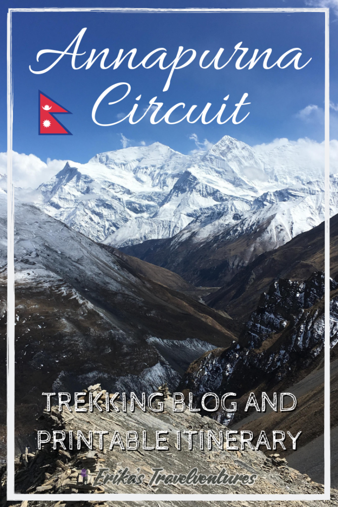
The Annapurna Circuit is a scenic, village-to-village trek that’s one of the most popular treks in Nepal. Spanning over 200 km and reaching an elevation of 5416m, it’s not for the faint of heart. However, the Annapurna Circuit CAN be completed by any healthy individuals who are up for the challenge!
If you want to know more about what to expect on the Annapurna Circuit, how to budget for it, what to bring, and more, check out my Ultimate Guide to the Annapurna Circuit
Click to download a PDF version of this Annapurna Circuit itinerary to keep with you on the trek!
Annapurna Circuit Itinerary Overview:
Start: Tal
End: Birethani
Direction: Counter-clockwise
Total # of Days: 13
If you decide to start your Annapurna Circuit itinerary from Besisahar, your first couple nights may be in the following villages:
- Day 1: Besisahar to Bhulbhule
- Day 2: Jagat
- Day 3: Danakyu
- Day 4: Koto/Chame
Note: If I was to trek the Annapurna Circuit again, I would start my itinerary from Besisahar.
I was told in Pokhara that the trail does not have nice views between Besisahar and Tal/Chame and it’s all trekking on the jeep road so it’s best to skip it. Both of these comments are NOT TRUE! The views were beautiful, and the trekking trail runs along the opposite side of the river from where the jeep runs.
Since I started my Annapurna Circuit itinerary from Tal, the following is my route:
- Pokhara to Besisahar (Taxi – 300 rupees, Bus – 500 rupees) – 5 hours, Besisahar to Tal – 4.5 hours (Jeep – 1500 rupees)
- Tal to Koto – 6.5 hours
- Koto to Upper Pisang – 6 hours
- Upper Pisang to Bhraka – 6 hours
- Ice Lake side trek – 6 hours, Bhraka to Manang – 30 min (Optional 2 days to Tilicho Lake side trek)
- Manang to Yak Kharka – 3 hours
- Yak Kharka to Thorung Pedi – 4 hours, High Camp viewpoint side trek – 2 hours
- Thorung Pedi to Muktinath – 7 hours (Pass Day!)
- Muktinath to Khagbeni – 4 hours, Visit to pilgrimage site – 1 hour
- Khagbeni to Larjung – 7 hours
- Larjung to Tatopani – 8 hours
- Tatopani to Ghorepani – 6 hours
- Ghorepani to Nayapul – 5 hours, Poon Hill side trek – 1 hour, Bus to Pokhara – 3 hours (bus for 110 rupees + taxi to Lakeside for 200 rupees)
Don't forget to purchase insurance before you leave for the trek!
You’ll reach an altitude of 5416m on the Annapurna Circuit regardless of itinerary. It’s common for people to feel symptoms of altitude sickness.
Before you leave for the trek, make sure that you have insurance to cover you if something happens at a high altitude and you need a helicopter evacuation. This could be anything from altitude sickness to a broken ankle. Check out World Nomads, which covers trekkers for high altitude evacuations in their “Advanced” plan.
Get an instant quote from World Nomads below!
Annapurna Circuit Itinerary:
Day 1: Pokhara to Besisahar (Taxi – 300 rupees, Bus – 500 rupees) – 5 hours, Besisahar to Tal – 4.5 hours (Jeep – 1500 rupees)
The tourist bus headed to the start of the Annapurna Circuit leaves from Pokhara at 6:30am. The bus one food/restroom stop along the way before reaching Besisahar around 12.
It’s possible to start hiking on this day to reach the next couple of villages, but I took a jeep to Tal, a town that’s two days away by foot. The jeep from Besisahar was 1500 rupees ($15) per person with no room for negotiation. It’s also possible to jeep up the Chame, further down the Annapurna Circuit itinerary.
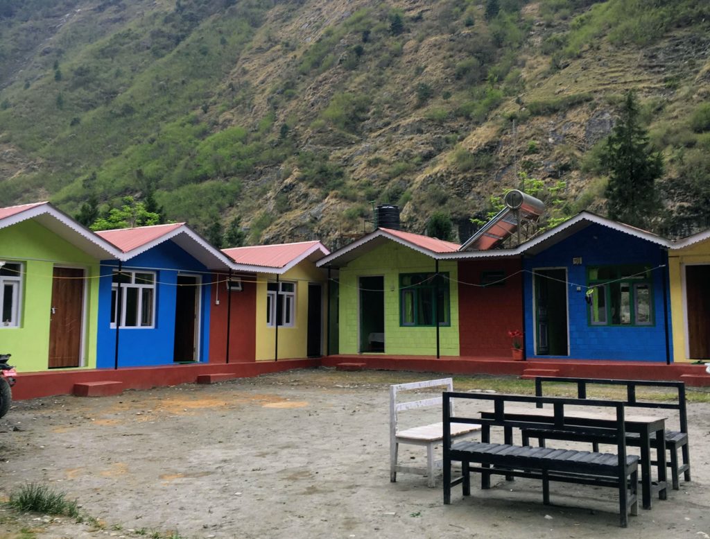
After an excessively bumpy ride, we arrived in Tal around 5pm. We stayed in the first guesthouse on the left for free, since we ate both dinner and breakfast there. They also had free wifi!
Tip: The group of people I met on this jeep, I ended up trekking the majority of the rest of the circuit with. Our group only grew along the way as we met more solo trekkers. It’s incredibly easy to meet people to trek with along the way!
Day 2: Tal to Koto – 6.5 hours
The next stop on the Annapurna Circuit itinerary is Koto or Chame towns. While I made it to Koto only because of an injury, others in my group continued to Chame.
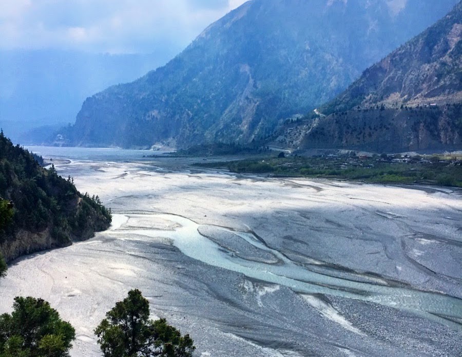
The trail from Tal starts gradual along the right side of the river with some ups and downs. The path is very obvious, marked frequently with the red and white stripe, and takes you through many small villages along the way.
Sometimes the trail crosses over to the left side of the river, including to a permit checkpoint in Dharapani, but most of the time it stays on the right. It’s possible here to follow the jeep trail that stays exclusively on the left, which is a more direct route between villages but less scenic at the same time.
We stopped in Danakyu village for a lunch break, after which there was a STEEP 600m incline up to Timang. Between Timang and Koto there are only very small villages that seemed like ghost towns, so I’d recommend staying either in Timang or pushing through to Koto/Chame.
In Koto I paid 100 rupees for a room, and the guesthouse had a free, semi-working gas shower, free phone charging, and free wifi.
Day 3: Koto to Upper Pisang – 6 hours
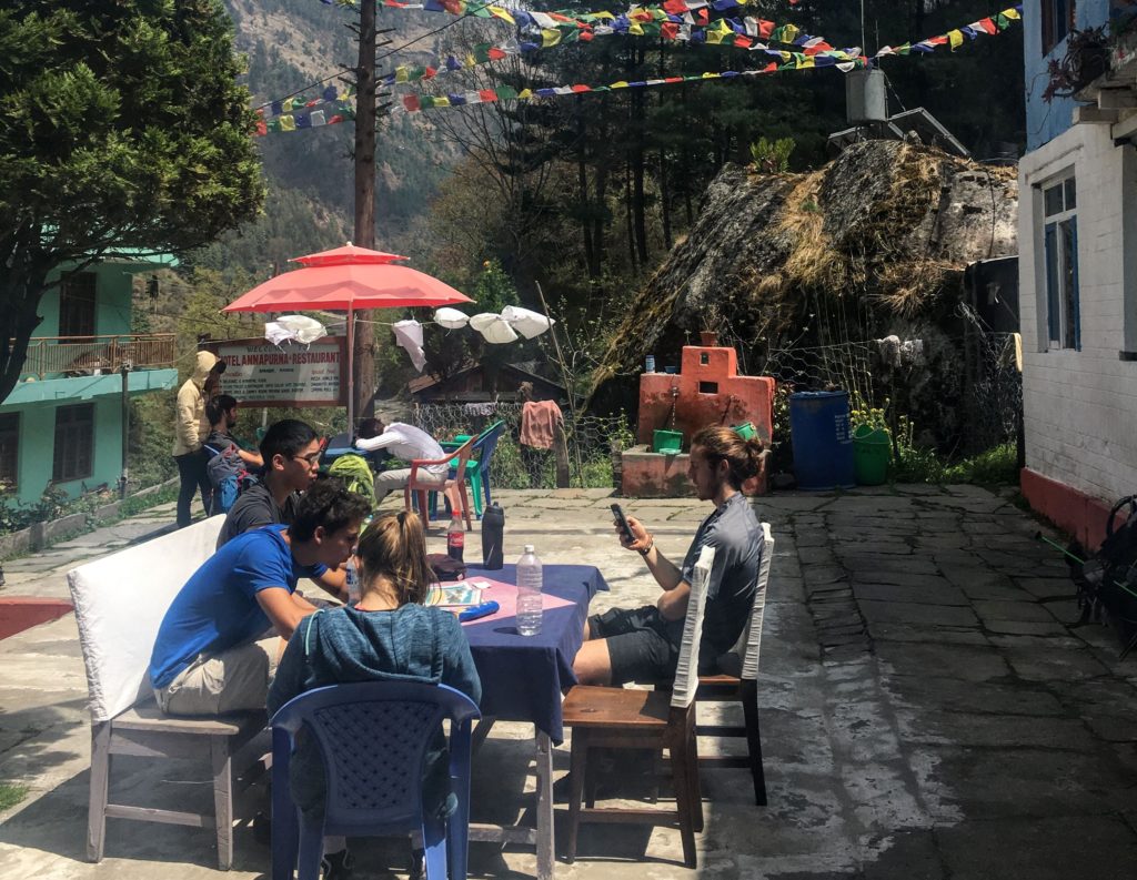
It’s an easy 30 minutes to get to Chame from Koto, which is the first large town on the Annapurna Circuit after Besisahar.
Anything you forgot to pick up in Pokhara, this is probably one of the cheapest places to stock up while you’re on the circuit. They have souvenir shops as well as trekking gear shops and pharmacies. The trail gets exponentially busier from here, since many people jeep to Chame from Besisahar to start the circuit trek.
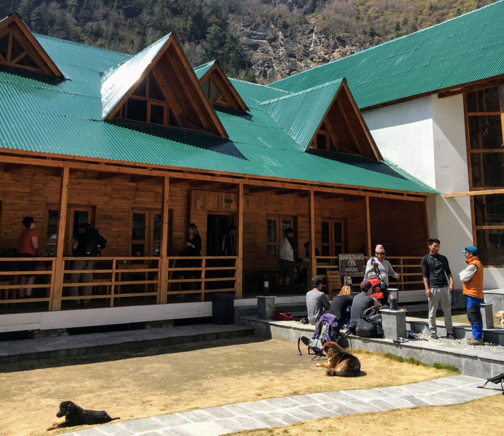
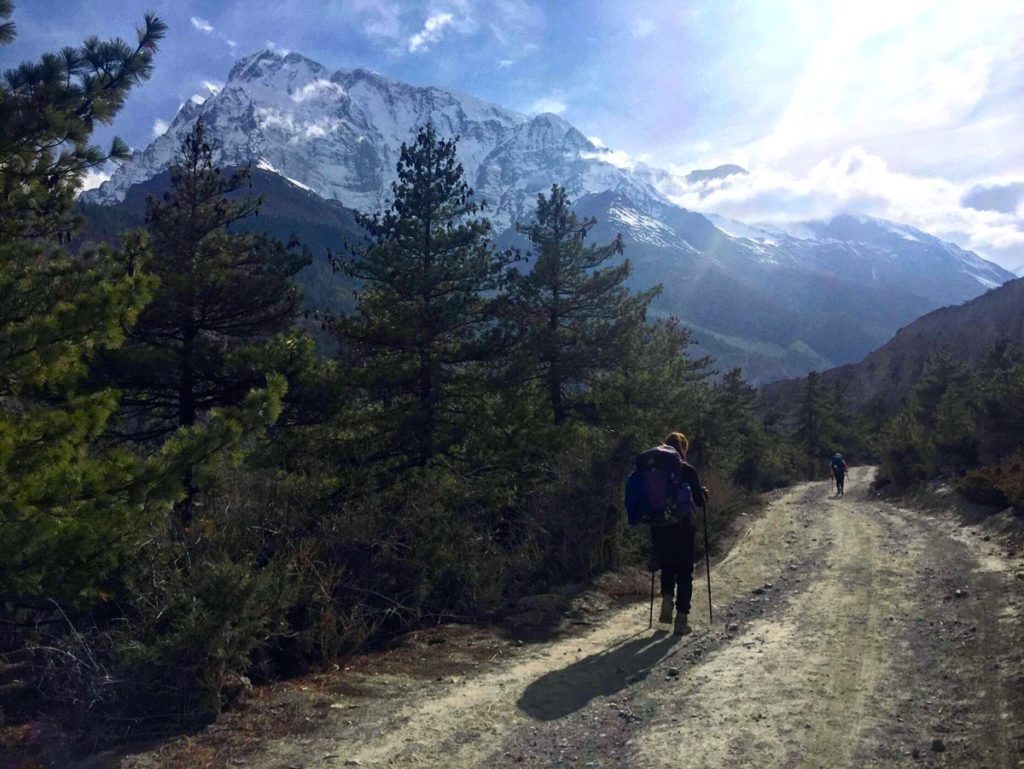
I recommend taking break at a lodge in Bhratang village that’s on an apple orchard. It looks like something straight out of a Colorado ski town! The trail after Bhratang is really beautiful, with waterfalls across the river and snowy mountain views behind you.
I stopped for lunch in Dhikur Pokhari, which gave me enough energy to hike the last straightaway over a wide plain to Upper Pisang. The village is built into the side of a steep hill, and we hiked up to a blue guesthouse with amazing rooftop views of Annapurna II mountain. We stayed for free and had free wifi and free charging again.
Tip: Although I recommend staying in Upper Pisang for the mountain views, an easier trail option on this day and especially the next day is going to Lower Pisang.
Day 4: Upper Pisang to Bhraka – 6 hours
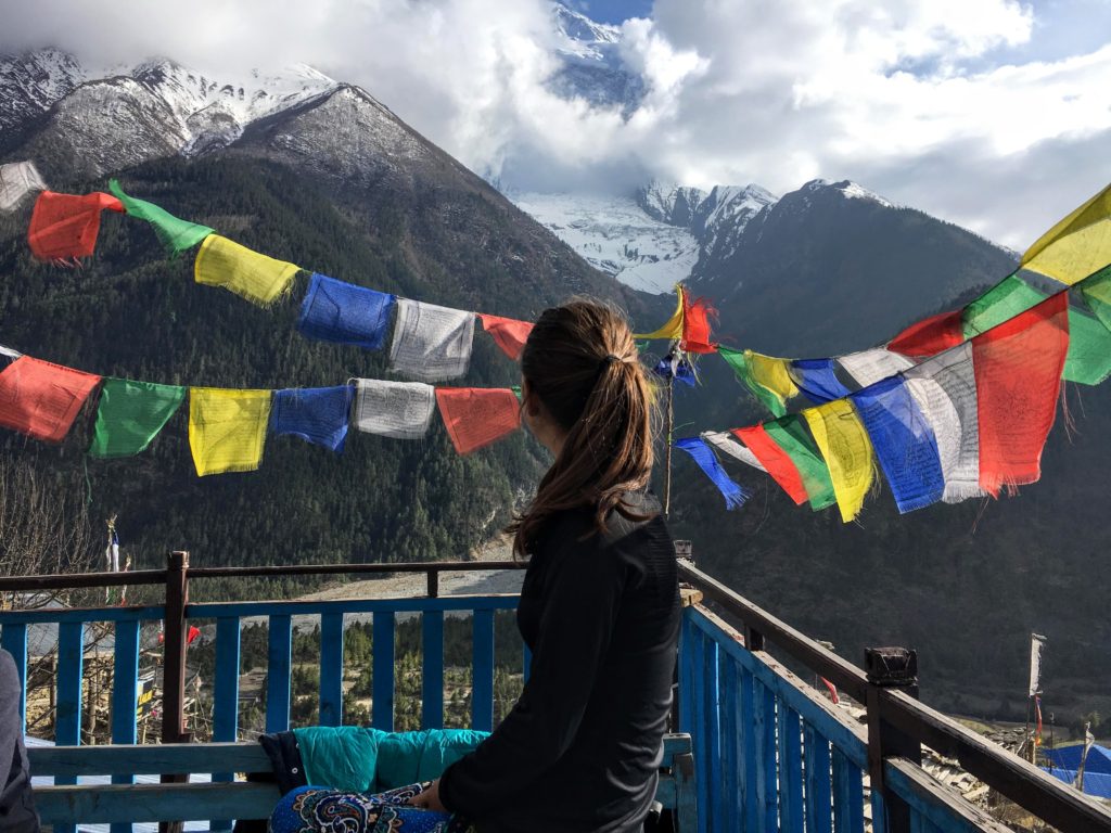
The trail from Upper Pisang to Ghyaru is a brutal 400m+ incline that’s switchback after switchback. For me, it was one of the hardest days on my Annapurna Circuit itinerary. There is a stupa at the top where you get amazing views before passing through Ghyaru village and its ancient-looking alleyways.
The path wraps around the side of the mountain and eventually you’ll come across a restaurant where we stopped for lunch. For me, some of the most beautiful views on the entire Circuit were from the bench in front of this restaurant.
We continued on this mountain trail to Ngawal, after which we were mostly walking on a jeep road and dropping elevation quickly. The jeep traffic became frequent here, so we were all covered in dust before we reached Bhraka and its famous 500 year old monastery.
We stayed in the first guesthouse on the left for 100 rupees per person for night five on the Annapurna Circuit. It had a view of the monastery from the front terrace, and amazing views of Annapurna III and Gangapurna from the back porch. The lodge also had an attached bakery, free wifi, and one gas shower room with a western toilet.
Day 5: Ice Lake side trek – 6 hours, Bhraka to Manang – 30 mins
It’s recommended to stay at this elevation (~3500m) for two nights to help your body acclimatize. On our Annpurna Circuit Itinerary we stayed in Bhraka for one night, then Manang for one night. Many people choose to stay two nights in Manang instead because it’s a bigger town.
Ice Lake Side Trek
On this “rest day”, myself and two others did the Ice Lake side trek from Bhraka. We checked out, left our big bags at the guesthouse and set off after breakfast.
The Ice Lake side trek starts alongside the large monastery and through the neighborhood around it, and is consistently uphill with some viewpoints in between. It took an hour to reach the first viewpoint of the valley, another hour to reach a nice restaurant where we stopped to rest (cheaper food prices here than in town!), and one more hour to reach the lake.
The lake itself is not spectacular, but the views of the mountains in the valley during the hike up are absolutely breathtaking!
Bhraka to Manang
After returning to Bhraka we hiked an easy 30 mins and slight uphill to Manang.
We stayed in the first massive lodge, which was quite fancy with fast restaurant service, free wifi, attached bathrooms in the rooms with western toilets, and a bakery/cafe next to it. We were charged 400 rupees per room, split between two people per room. It was a higher cost for more luxuries.
Tip: Manang is the last town where you’ll find grocery stores and trekking stores. It’s a good idea to stock up on snacks, yak cheese, and other necessities before prices for these go up monumentally!
On my next Annapurna Circuit Itinerary: Tilicho Lake Side Trek
Tip: If I was to hike the Annapurna Circuit again, I would do the Tillicho Lake side trek that starts from Manag. It’s more difficult and dangerous than the Ice Lake side trek because of landslide-prone areas and higher elevation gain. However, the views of Tilicho Lake and the surrounding mountains are supposed to be beautiful. It requires an overnight stay or two at Tilicho Base Camp, but helps immensely with acclimatization.
Check out Intrepid Road’s videos about Tilicho Lake!
Day 6: Manang to Yak Kharka – 3 hours
It’s a trekking rule of thumb to never sleep more than 500m above where you slept the last evening, so this day is a short one to get from Manang (3540m) to Yak Kharka (4050m). There’s an initial 100m ascent to Ghusang, and the rest of the incline is a gentle one.
We arrived in Yak Kharka in time for lunch, and ate at a cozy-looking enclosed common area of a guesthouse that we ended up staying at for the night. We stayed for 100 rupees per person. There was one cold shower room, and no wifi.
Day 7: Yak Kharka to Thorung Pedi – 4 hours, High Camp viewpoint side trek – 2 hours
Yak Kharka transformed into a winter wonderland overnight! It’s not uncommon for trekkers to experience their first snowy trails around this altitude of the Annapurna Circuit Itinerary.
We had to trek through the slippery snow for the initial incline until the sun came out to melt it all away. There’s a long and strenuous uphill after crossing over a river. After the incline, the trail to Thorung Pedi is relatively flat, but the gravel below your feet is not so stable (landslide zone).
Tip: The trail is crowded here, but make sure you keep enough space between you and the people around you when crossing landslide areas.
We arrived in Thorung Pedi around lunchtime. We checked in at the first guesthouse we saw (paid 200 rupees per person), and rested for a bit in their common room. Here we had to pay per hour for charging electronics, only had a cold shower attached to our room, and there was no wifi.
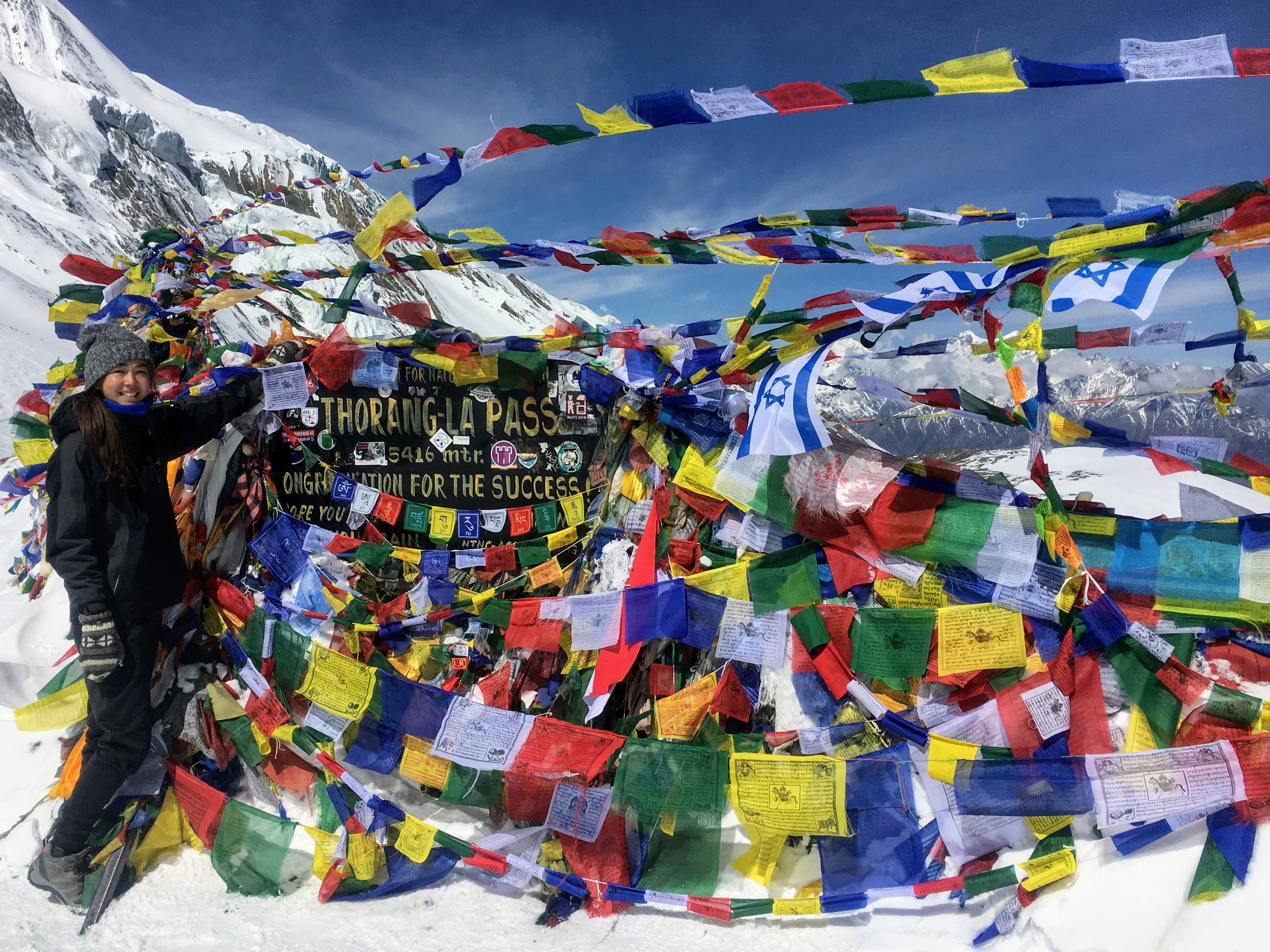
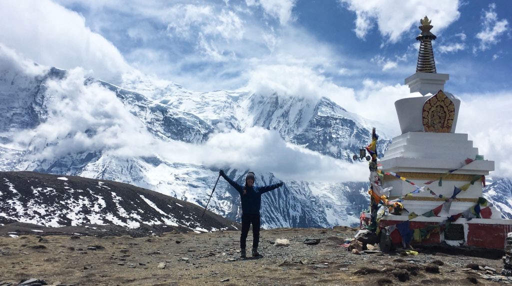
This was our last night before going over the Annapurna Circuit’s highest point: Thorong La Pass!
To acclimatize, take a trek up to High Camp in the afternoon.
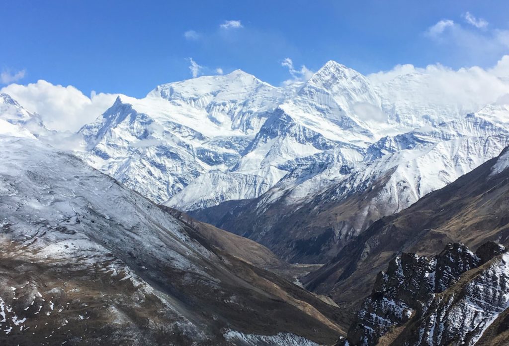
It’s a steep uphill of all switchbacks that you’ll climb again on Pass Day. It took about 45 minutes to reach High Camp, and another 30 minutes or so to go even higher to a viewpoint nearby. It’s 100% worth the extra uphill to get the 360 degree view of the Annapurna mountains and Gangapurna. Plus you’re at 5000 meters which is great for acclimatization.
Tip: Go to bed early this day and order breakfast for the morning so you’re ready for pass day! It’s a good idea to buy some bread from the guesthouse or other snacks for the road.
Planning on trekking the Annapurna Circuit? Read my Ultimate Guide to learn what you need to know before you go!

Day 8: Thorung Pedi to Muktinath – 7 hours (Pass Day!)
Pass day every Annapurna Circuit Itinerary is the most challenging day!!
We woke up at 4:25am to get breakfast from the guesthouse at 4:30 (some people were leaving at 4 or 4:30 but I think this is a bit excessive). It was close to 5am and still dark when we set out for the pass.
It took about an hour this time to get to High Camp with all of our gear. Directly after High Camp the trail alternates between flat snowy terrain where the wind would blow fiercely over us, and steep rocky terrain. This was the only day that I wished I had microspikes or crampons, but I made it through without them by stepping carefully and using my poles for leverage. If you slip here, it’s a loooong way down.
The trail is crowded with other trekkers who left around the 4-5am timeframe, so sometimes you need to pass people on the snowy slope which can be quite dangerous. This goes on for about three hours, with hill after hill appearing in front of you when you’ve reached the top of the last one. When the trail becomes exclusively snow-covered and you start to hear cheering in the distance – you’ve made it!!
I was one of the first to arrive at Thorong La Pass at around 9am! There’s a conveniently placed tea shop right at the top where you can get a $3 cup of tea while warming up and resting for the downhill.
The downhill was also snowy with crumbling gravel beneath the snow.
The first set of guesthouses you’ll reach all have restaurants attached to them. Its about an hour more from here to reach the large town of Muktinath.
In Muktinath we stayed at Bob Marley guesthouse, where they put six beds in one room for us to stay for free. The food was expensive, but after conquering the pass everyone was in celebration mode and splurging on food and drink. Beers were 550 rupees for a large bottle, which is cheaper than some of the popular bars in Pokhara! The wifi here was barely existing, but my NCell SIM card was working for the first time. They also had a hot shower and free charging.
Day 9: Muktinath to Khagbeni – 4 hours, Visit to pilgrimage site – 1 hour
Note: Although Khagbeni is a detour from Jomson, I think it’s worth it to go through this little fairytale town.
We checked out of Bob Marley guesthouse in Muktinath, took our bags with us, and started this day on our itinerary with a trip to the Hindu/Buddhist pilgrimage site just outside of town. Here, all four elements are ever-present: fire (from a lit natural gas leak), water, earth, and wind. It’s extremely busy with people from India and Nepal who come to the site as pilgrims and tourists.
After the visit we took the upper road to Khagbeni, which starts close to the pilgrimage site. You can also follow the jeep road from Muktinath but the upper trail is much more scenic. It takes you through some old villages that seem to be untouched by the trekking industry, then over some desert plains with alien-like rock formations.
The trail becomes a gradual downhill and you’ll first see the village, Tiri, in the distance looking like a green little oasis before you turn the corner to the left and see Khagbeni. To the north of here is the restricted Upper Mustang area.
Khagbeni
Khagbeni is a bit of a maze of alleyways you’ll need to navigate to get to the center, where there is a monastery and more guesthouses. You can also find jeeps here that are taking pilgrimage tour groups back to Pokhara.
We had lunch at “Yak Donalds” for some “Yak Happy Meals” and to use their wifi, then stayed at a guesthouse that was just around the corner from it. We paid 100 rupees per person, and I slept in a three person room with an attached western toilet and cold shower. There one outlet in the room for charging, but we had to pay extra for wifi.
Day 10: Khagbeni to Larjung – 7 hours
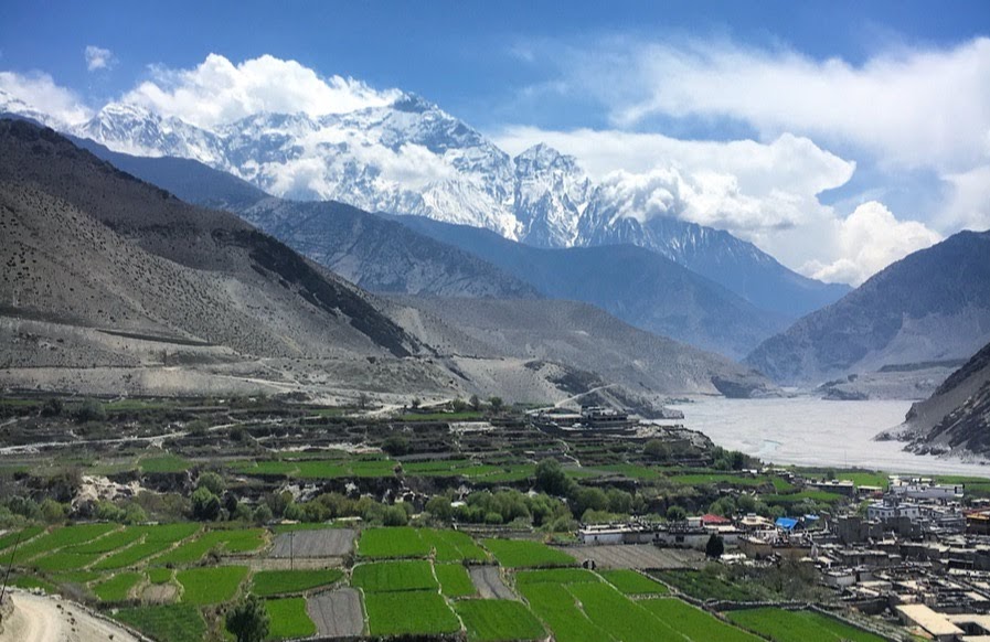
It’s a two hour flat trek across the riverbed from Khagbeni to Jomsom, the large transit hub of the region, complete with a jeep stand and airport (and the NCell sim works again!).
Aside from one girl in our group who took a mountain bike down from Khagbeni (for $55 they give you a bike to rent and will jeep your bags down to Tatopani), the rest of the people I was trekking with took a jeep from Jomsom back to Pokhara.
Cross the river to the left after Jomson to stay on the hiking trail. It’s all flat when you pass a Tibetan settlement that you can wander through as well as some small villages. You’ll pass a guarded army camp that you CAN’T wander through but the trail goes next to.
Don’t Get Lost
After the camp I stayed on the left side of the riverbed where my map showed the hiking trail should’ve continued but I managed to get completely lost. The mountain I was hiking over was covered in small goat trails, so although I thought I was going in the wrong direction, the trail would disappear or end where there had been a previous landslide.
After wandering in the forest for an hour and not finding any locals to ask for directions, I decided to backtrack and cross over the river to the right side at a bridge directly after the army camp, which led me to Tukuche village.
I reached Larjung around 4pm. I stayed there for the night at the first guesthouse on the left, for 200 rupees per room. There was dismal wifi, with no NCell service, and only cold showers.
Day 11: Larjung to Tatopani – 8 hours
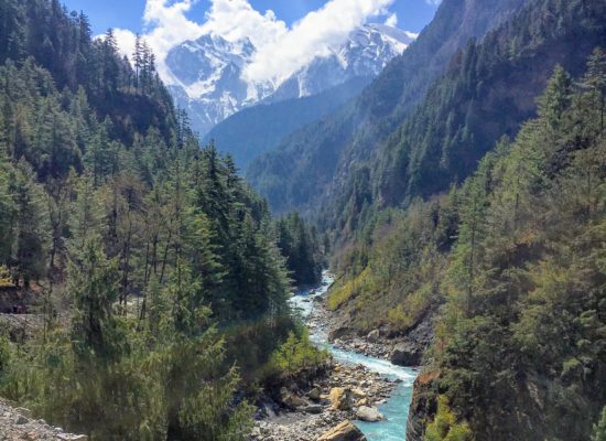
Leaving Larjung, the trail was mostly flat as I crossed over a feed-in river, then over a suspension bridge to the hiking trail.
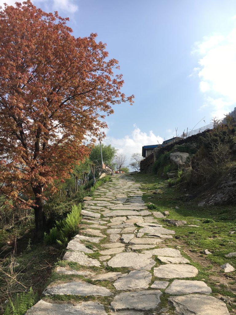
The section of the trail after Larjung is so stunning, with its stone roads and tiny villages built into the foresty mountainside! This day on my Annapurna Circuit Itinerary really made it worth walking down the rest of the circuit for me. Eventually it crossed back over to Ghasa town on the right where there’s a permit checkpoint.
After Khabre the trail is again so beautiful as you make your way up and down through many little villages. There were tons of little lizards, water buffalo, and cannabis plants along this stretch. The last section before Tatopani was an extremely wide jeep road that looked like they were still trying to make wider.
Tatopani is another large town, and a great place to spend the night on your Annapurna Circuit Itinerary. I stayed at a hotel that had a single room available for 150 rupees. I paid 50 rupees for a gas shower, and NCell had service again so I didn’t need to pay for wifi.
This town is famous for the hot springs that are naturally occurring there that trekkers and locals can rest and bathe in (Tato = hot, Pani = water in Nepali).
Day 12: Tatopani to Ghorepani – 6 hours
This day on my Annapurna Circuit Itinerary was one of the most challenging for me because of the continuous uphill. When you leave Tatopani there’s a permit checkpoint, then you cross the river to the left side and start up an incline.
The views are amazing, starting with a monastery at the top of the first uphill, then the trail goes up through several villages built into the side of the mountain. Once you get over the first mountain you see, theres another one behind it, and then another.
Eventually you’ll see a radio tower in the distance, which is on the trail to Poon Hill. Soon after, you’ll see some large hotels built on the top of the mountain to the left of it – Ghorepani! After an intense uphill you’ll come across a “Welcome to Ghorepani” sign, but Ghorepani village is still another 20 minutes uphill.
I stayed at a guesthouse straight down the main road for free, with free charging, cold showers, and limited Wifi (No NCell).
Tip: Ask the locals where the trail to Poon Hill starts and find a guesthouse that’s close to there, to save yourself some time in the morning. As you enter town and climbs few stairs, it’s to the right.
Day 13: Ghorepani to Nayapul – 5 hours, Poon Hill side trek – 1 hour, Bus to Pokhara – 3 hours (bus for 110 rupees + taxi to Lakeside for 200 rupees)
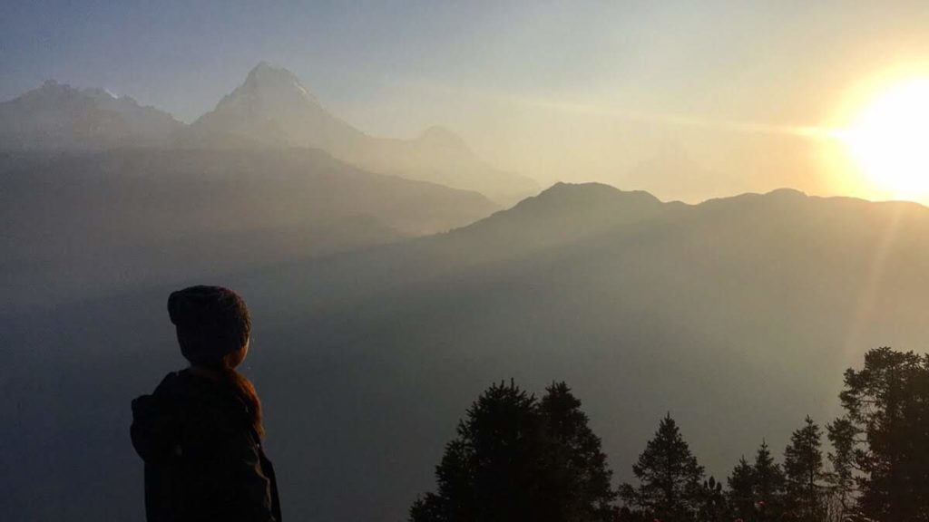
Since the guesthouse didn’t offer breakfast in the early morning, I left around 5am to have breakfast upon returning. In 30 minutes I was at the top where there’s a tea shop, a viewing tower, and a large platform lined with benches. It’s a majestic view and totally worth the extra uphill from Ghorepani to get your last view of the Annapurna mountain range.
After breakfast it was 5 hours of hard-on-your-knees downhill stairs and steep dirt trails. Since the Poon Hill trek is popular to do on its own from Pokhara, the trail is incredibly obvious (you really don’t need a guide even though it’s great to support the local economy.) The trail takes you through a bit of forest with waterfalls, then through pretty villages filled with little gift/snack stands and guesthouses with beautiful exteriors. Birethani, the end of the circuit, sneaks up on you at the end of the valley where the rivers meet.
20 minutes from here after a final permit checkpoint is Nayapul. Here you can wait at a row of shops that doubles as a local bus stand. The local buses come about every hour, and I had to keep insisting to the taxi drivers there that I preferred to take a bus. For 110 rupees I was packed like a sardine in the local bus, but reached peaceful Pokhara in 3 hours. I shared a taxi back to the lakeside of town with another trekker for 100 rupees each.
Planning on trekking the Annapurna Circuit? Read my Ultimate Guide to learn what you need to know before you go!
Looking for an even bigger challenge? Take a look at my guide to the Three Passes Trek + Everest Base Camp !
Pin This Post!